✓ Added to cart
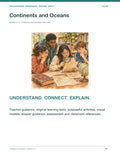


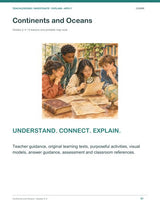
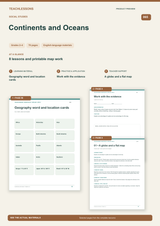
Continents and Oceans | 8 Lessons with Printable Map Work | Grades 2–4
Geography Complete – Ready-to-Use Curricu... · from $149.90 See bundle →
Digital download · nothing is shipped
- Instant download: the download link appears right after checkout and is also emailed to you.
- Format: PDF, ready to print or project.
- TeachLessons Guarantee: if it does not fit your standards or pacing, email us within 30 days of purchase and we adapt it at no extra cost. How the guarantee works
Continents and Oceans | 8 Lessons with Printable Map Work | Grades 2–4
Continents and Oceans is a Grades 2–4 social studies resource with 8 lessons and printable map work. Each lesson moves from first ideas through modeled reasoning and work with evidence to an independent explanation, and every lesson has an answer and reasoning guide.
Students compare a globe and a flat map, learn the seven continents and five ocean names (as parts of one connected ocean), use a compass rose, the equator and hemispheres, locate places on a grid and plan a route. They finish by making a map that teaches.
What's Included
- Complete Unit: 70 pages (PDF) – teacher guidance, all student pages, answer guides and assessment
- Display Materials: 3 pages (PDF) – classroom posters and references
- Student Print Pack: 35 pages (PDF) – the student pages only, ready to print
- Printing guide (US Letter, fits A4); all files delivered as one ZIP download
What's Inside, Step by Step
- A globe and a flat map
- Seven continents in this model
- One connected ocean, five names
- Direction and the compass rose
- Equator and hemispheres
- Locate places with a grid
- Plan a route and explain it
- Make a map that teaches
Students Will Learn To
- Compare a globe and a flat map
- Name and locate the continents and oceans
- Use a compass rose, the equator and hemispheres
- Locate places with a grid and plan a route
Perfect For
- Grades 2–4 social studies classrooms
- Teachers who need balanced, ready lessons
- Homeschool geography
- Substitute-friendly lessons
- UK and Australia: Year 3–5
Why Teachers Choose It
- Original learning texts
- Answer and reasoning guides
- Access, challenge and discussion supports
- Transfer checks and assessment
Every resource is built around the curriculum you teach – and if something doesn't fit your standards, the TeachLessons Guarantee applies: we adapt it for you.
Created with AI assistance. Texts and illustrations were developed with ChatGPT (OpenAI) and Claude (Anthropic) and edited for classroom use; production notes are in the complete unit.
Frequently Asked Questions
Are answers included?
Yes, every lesson has an answer and reasoning guide.
How long are the lessons?
About 45–55 minutes each.
Are blank maps included?
Yes, printable map work for every lesson.
$14.99 – buy now
PDF · instant download · 70 pages
🔒 Secure checkout · ♾️ reuse every yearFAQ about this resource
More Geography resources for Elementary School


Our summary: Continents and Oceans | 8 Lessons with Printable Map Work | Grades 2–4
Continents and Oceans | 8 Lessons with Printable Map Work | Grades 2–4 is a fully worked-out teaching resource for Geography at Elementary School level (Grades 2–4). Its strength is that it is finished: worksheets, answer keys and teacher notes are all there, so a lesson can start without extra prep.
Teachers covering a topic at short notice, early-career teachers under planning pressure, and anyone picking up a cover lesson — and any situation where a lesson has to be ready today.
An editorial assessment of structure, scope and classroom use. It is not a customer review.